English
 Français
  Italiano
  Deutsch
 -
FURNITURE
Featured item
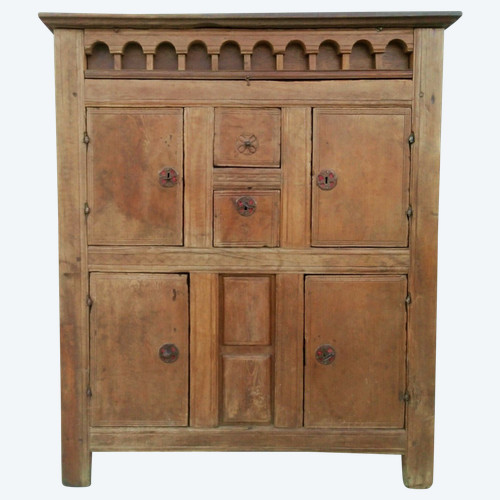
 Louis XIV oak sacristy cabinet sideboard
1.300 € EUR
Louis XIV oak sacristy cabinet sideboard
1.300 € EUR
-
Featured item
Jambhala statue - India
2.500 € EUR
-
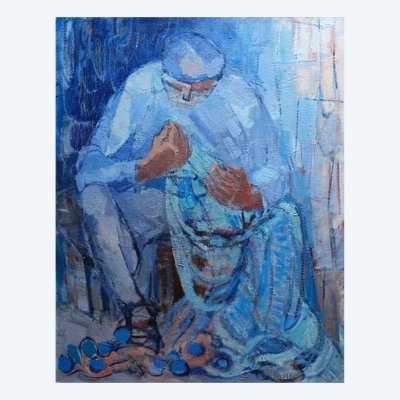
Featured item
The fisherman with the net
3.450 € EUR
-
WORLD OF ANTIKEO