English
 Français
  Italiano
  Deutsch
 -
FURNITURE
Featured item
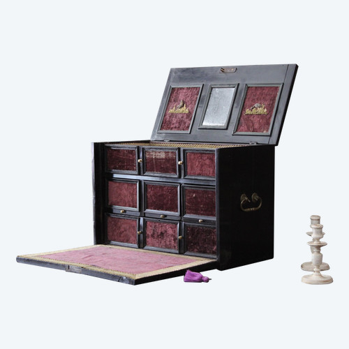
 Blackened wooden cabinet, 17th century.
2.700 € EUR
Blackened wooden cabinet, 17th century.
2.700 € EUR
-
Featured item
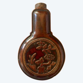
Powder or tobacco pear in Boxwood. XIXth Asia.
150 € EUR
-
Featured item
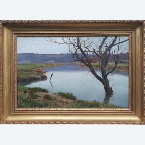
José WEISS - A river in flood in Sussex
1.800 € EUR